

I will create professional GIS maps and perform vegetation analysis using Sentinel-2 or Landsat data


Service Description
I will create professional GIS maps and perform remote sensing analysis using satellite data (Sentinel-2, Landsat, MODIS, etc.).
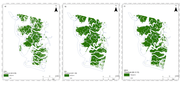
My services include vegetation mapping (NDVI, NDMI, CMRI), land cover classification, shapefile creation, and map layout design with legends, scale bars, and north arrows.
You will receive a high-quality map ready for research, reports, or presentations.
Technology Used
Google Earth Engine, QGIS, ArcGIS, Excel, eCognition, ERDAS IMAGINE
Frequently Asked Questions
Q: Can you perform classification for my area?
A: Yes, I can classify land cover using indices or supervised classification (e.g., SVM, Random Forest).
Q: What data sources do you use?
A: Mostly Sentinel-2, Landsat 8, or client-provided data.

Share This Service