


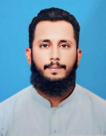
Muhammad Zeeshan Javed
Bahawalpur,
PK.
I am a Civil Engineer with 7 years of practical field surveying experience, specializing in survey data processing, CAD drafting and preparation of 2D engineering drawings using AutoCAD and Civil 3D.
My field experience includes topographic surveys, boundary layouts, road surveys and existing-condition/as-built work. I have practical experience working with survey point data, coordinates, elevations and field information and converting this information into organized CAD drawings.
I can help you with:
• Survey data / Excel / CSV to AutoCAD or Civil 3D
• Survey point plotting and 2D survey drafting
• Topographic survey drafting
• Road and site survey drawings
• As-built and existing-condition drawings
• PDF, scanned drawing or hand sketch to CAD
• 2D AutoCAD/Civil 3D drafting
• CAD drawing cleanup and organization
Deliverables:
• DWG, DXF and PDF
My practical experience includes working with:
• Survey coordinates and elevations
• Point numbers and point descriptions
• Field survey information
• Existing site features
• Building/site layouts
• Roads and road survey information
• CAD layers, linework and annotations
I focus on producing clean, organized and easy-to-use CAD drawings while following the client's provided standards, templates and requirements.
If you have survey data, field measurements, an existing drawing, PDF, scanned plan or sketch that needs to be converted into CAD, feel free to send me the files and I can review the scope before we begin.
Software: AutoCAD | Autodesk Civil 3D
Please contact me before starting a large or complex project so I can review the files and confirm the scope, deliverables and timeline.
Contact Me Now
No reviews yet


- Latest Activities